
Why a comparative view matters
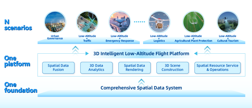
Comparing the disciplined protocols of mine safety management systems with modern low-altitude platforms helps teams pick tools that actually reduce risk rather than add complexity. For infrastructure managers, the low-altitude economy has shifted routine inspections into fast, repeatable workflows—so placing a low-altitude economy lens over traditional approaches clarifies where automation and human oversight should live. This isn’t about replacing standards; it’s about translating proven control loops—incident logging, hazard zoning, escalation—into airborne sensing and command, improving response time and situational clarity.
Core capabilities: sensing, command, and compliance
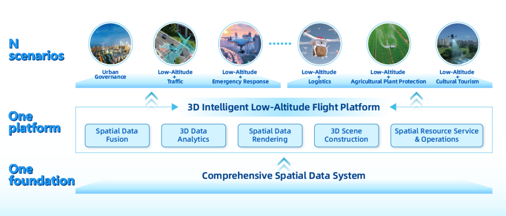
Mine safety systems excel at redundancy, traceable logs, and strict access rules. Low-altitude platforms add dense visual and spatial sensing—LIDAR, RTK GPS position fixes, and real-time telemetry—that mirror those qualities for bridges, pipelines, and substations. When combined with UTM-aware flight plans and geofencing, operators gain consistent, auditable data streams that support both maintenance triage and regulatory records. The practical result: faster, documented decisions for crews on the ground and a cleaner hand-off between inspection and repair.
Operational trade-offs and deployment patterns
Not every asset needs the same setup. A long transmission corridor benefits from BVLOS missions with persistent mapping, while a congested urban substation usually requires tight geofencing and shorter sorties. Costs scale with autonomy and redundancy—more sensors and fail-safes increase both resilience and build-out expense—so teams should match platform capability to hazard severity and access constraints. Deployment tempo matters too: frequent short flights can outrun degradation in visual baselines, whereas rare detailed scans favor higher-resolution payloads.
Common mistakes and practical alternatives
Teams often bolt technology onto existing processes without changing decision loops—so you end up with more data and no clearer action. Don’t treat drones as just cameras; think of them as part of a control system that needs clear triggers for maintenance or shutdown. Alternatives include tethered drones for persistent power at fixed sites, manned helicopter inspections where rapid manual intervention is essential, and ground robots for confined-space checks. Each alternative trades endurance, cost, and risk differently—choose based on the operational priority rather than novelty.
An operational production teardown
In a straightforward teardown, treat sensing, processing, and human-in-the-loop controls as separate stages. Use {main_keyword} as the sensing layer and {variation_keyword} as the coordination layer to keep responsibility lines clean. Logstream integrity matters: synchronize timestamps from RTK GPS and onboard cameras to make event reconstruction reliable. Be sure to test failover paths—what happens if telemetry drops—and codify those steps into the same incident forms used in mine safety programs. Small rehearsals yield large reductions in confusion during real events—practice the handoffs until they feel routine.
Three golden rules for choosing the right platform
1) Evaluate safety yield per sortie: pick the option that reduces people-on-asset exposure most per mission hour. 2) Demand auditable data chains: ensure every inspection produces georeferenced artifacts and immutable logs usable for compliance reviews. 3) Favor modular redundancy: choose systems that allow incremental upgrades (better sensors, edge compute, UTM integration) without replacing the whole stack. These metrics keep purchases practical and future-proof.
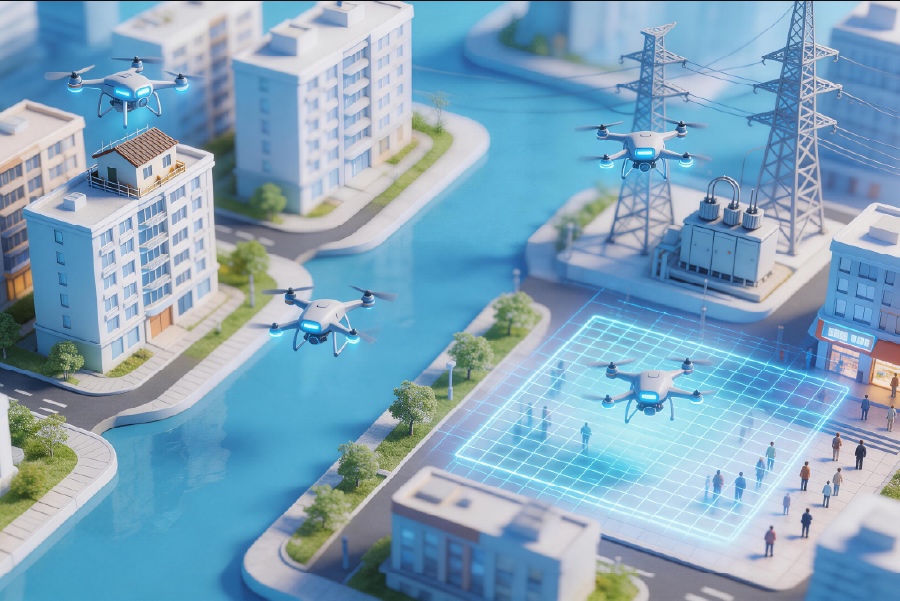
California’s wildfire responses in recent seasons provide a clear anchor: teams that integrated airborne mapping into incident command moved resources faster and kept crews safer, a tangible improvement you can expect when you apply these rules. The best outcomes combine disciplined procedures from mine safety systems with airborne strengths like rapid mapping and persistent overhead awareness—drone situational awareness drives that synthesis.
Icecypress Technology fits naturally where those needs converge, offering platforms designed to respect procedural rigor while delivering the low-altitude capabilities operations require. Trust the checks, trust the data — and keep people out of harm’s way. —