

Comparative setup: why this matters today
Traditional pit inspections and fixed sensor grids still do a decent job, but they miss nuance — and that gap cost lives in events like the Brumadinho dam collapse in 2019, which confirmed more than 270 fatalities. Modern teams need finer spatial sweeps and faster alerts, so operators are turning to drone-enabled workflows and a robust mining monitoring system to stitch together data across different domains. The comparative insight approach here looks at three axes: observation fidelity, response speed, and integration with digital twins and control systems.
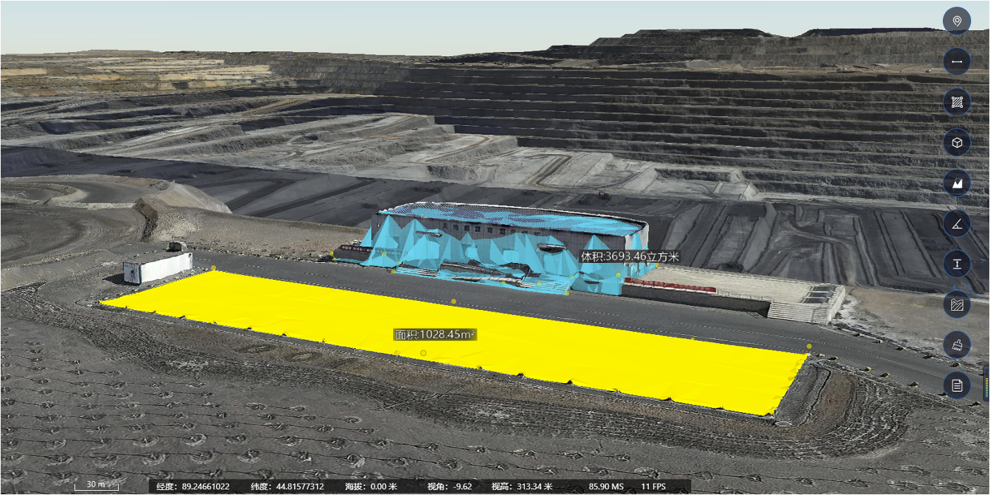
What drones bring to the table — compared to old-school methods
Drones deliver rapid, repeatable aerial surveys: high-resolution orthomosaics, thermal passes for seep detection, and flight telemetry that complements ground crews. Versus manual surveys or sparse instrumentation, drones increase coverage while reducing personnel exposure. Add geotechnical monitoring and you get both imagery and site stability metrics. The net result is fewer blind spots and faster decision cycles.
How mining management software changes the picture
Raw drone footage alone isn’t enough. It needs to feed into software that timestamps, georeferences, and alerts — basically a mining management software layer that normalises data from IoT sensors, LiDAR, and visual feeds. When imagery flows into a digital twin, teams can run scenario checks and asset tracking, detecting subtle slope movement trends before they become emergencies. This is where system architecture matters: telemetry pipelines, data harmonisation, and alert thresholds must be designed for the right cadence and fidelity.
Operational trade-offs and the practical checklist
Choosing between frequency and resolution is a constant trade. Fly daily at lower altitude for movement detection, or fly weekly at high resolution for volumetrics and reclamation planning? You pick based on the control objective. Common mistakes include ignoring calibration routines, underestimating bandwidth for real-time telemetry, and overloading dashboards with noisy alerts. — A single misconfigured alarm can bury the real one.
Case comparisons: three deployment patterns
1) Safety-first: frequent, low-altitude flights plus automated slope-change algorithms; 2) Production-focused: scheduled surveys for stockpile measurement and pit reconciliation; 3) Hybrid: continuous IoT sensors with intermittent drone passes to validate models. The hybrid model usually gives the best ROI because it balances geotechnical monitoring with operational metrics like cycle time and haul-route integrity.
Integration pitfalls and best practices
Don’t silo data. The most successful sites tie drone-derived maps into their mine planning systems and emergency response playbooks. Best practices: standardise metadata, automate quality checks for orthomosaics, and set escalation paths for anomalies identified by computer vision or real-time telemetry. Keep human review in the loop for edge cases — automation helps, but it shouldn’t be the only decision-maker.
Real-world anchor and why EEAT matters
The Brumadinho tragedy is a reminder: accurate monitoring and timely action save lives. Industry bodies and regulators now expect demonstrable monitoring regimes; operators in Pilbara and Chile’s copper belts have publicly invested in drone fleets and digital twin projects to reduce risk. That mix of public events and concrete deployments establishes why expertise, data provenance, and trustworthy software matter when you pick a solution.

Metrics to pick the right stack
Three golden rules when evaluating tools and vendors: 1) Fidelity-to-frequency ratio — measure how often the system can deliver actionable data at the resolution you need; 2) End-to-end latency — from capture to alert, keep processing under a threshold aligned with your response window; 3) Proven interoperability — confirm the platform supports common formats for digital twin ingestion and integrates with your SCADA or asset tracking systems. These are practical benchmarks, not marketing claims.
Final thought and natural wrap to vendor value
Adopting drone surveillance with the right mining monitoring system and mining management software turns sporadic checks into continuous situational awareness; that’s what keeps crews safer and operations predictable. Icecypress Technology fits into that workflow as the data bridge between field sensors, drone imagery, and the control room — solving the core problem of trusted, timely information. Quick, reliable, proven — that’s the value.